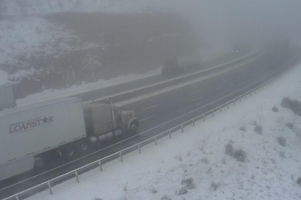
Up to 8 Inches of Snow, Dense Fog Possible on I-80 Summit Tuesday
Heavy snow could create "very difficult" travel conditions on Interstate 80 between Laramie and Cheyenne tomorrow through early Wednesday, the National Weather Service in Cheyenne says.
A Winter Storm Warning is in effect for the southern Laramie Range from 6 a.m. Tuesday to 9 a.m. Wednesday, where up to eight inches of snow could fall.

The NWS says areas of dense fog with visibilities near zero will also be possible Tuesday, especially between Telephone Canyon and Vedauwoo.
Drivers are encouraged to call 511 or visit wyoroad.info for the latest road closures and travel advisories.

Here's a look at the latest winter weather headlines across the area. Winter Storm Warnings have been issued for the Snowy Range and southern Laramie range. Winter Weather Advisories remain in effect for the Sierra Madre and Arlington/Elk Mountain area through 9AM Wednesday. Precipitation will work in this afternoon and evening with snow levels starting around 7500’. As temperatures cool, expect snow levels to fall to as low as 5500’ by late Tuesday. Most accumulation should be above 6500’. On and off rain showers and fog are expected elsewhere.

Here's a look at the precipitation timeline and probabilities through early Wednesday. Showers developing this afternoon will increase in coverage tonight through Tuesday, before tapering off by Wednesday morning. Nebraska should see mainly rain, but rain is expected to turn to snow at some Wyoming locations as temperatures cool. Locally heavier precipitation rates could lead to an early rain to snow transition. Patchy dense fog and low visibility is also likely late tonight through Tuesday night.
5 Tips for Driving in Foggy Conditions
WYDOT Urges 'Don't Crowd the Plow!' After 105 Plows Hit in 5 Years
Gallery Credit: Joy Greenwald
More From K2 Radio