Up To 18 Tornadoes Reported in Wyoming During Severe Weather on Monday
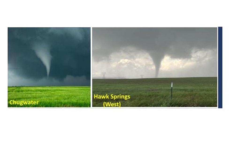
The numbers still aren't concrete, but as many as 18 tornadoes were spotted in Wyoming as severe thunderstorms dropped baseball-sized hail and brought high winds to much of the state.
Julie Gondzar with DayWeather in Cheyenne said Tuesday morning that seven tornadoes were confirmed to have touched down across the state.
The following locations are the sites where Gondzar said tornadoes were confirmed to have touched down in the state:
- Four miles east-northeast of Grayrock Reservoir in Goshen County;
- Eleven miles northeast of Cheyenne in the Hillsdale area;
- Carpenter, where a tornado destroyed a barn;
- Two miles west of Kaycee in Johnson County;
- A skinny tornado touched down near Burlington in Big Horn County, some 25 miles west-northwest of Worland;
- 20 miles southwest of Douglas;
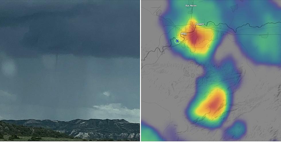
- One tornado briefly touched down two miles west of Bar Nunn, just north of Casper.
And one funnel cloud was spotted near Cody.
The National Weather Service in Riverton said thunderstorms likely saw two separate tornadoes touch down in western portions of Washakie and Big Horn Counties.
Kaycee saw multiple touchdowns, the weather service said, with at least two and possibly three being tracked simultaneously at one point Monday night.
The National Weather Service's Riverton office reported at least six tornadoes touching down in the region, while the Cheyenne office -- noting that reports have not been finalized, and the numbers are not concrete yet -- said eight to 12 tornadoes touched down in the Cheyenne area.
Hail was the main impact of the storm. It caused significant damage in areas across Wyoming, with softball-sized hail hitting a number of vehicles in the Wheatland area as a supercell moved through.
Tennis ball- to baseball-sized hail was reported northeast of Cheyenne. In Cheyenne, hail varied greatly in size, from pea-sized to tennis ball-sized.
Severe thunderstorms hit the northern and far eastern parts of Wyoming, with the most dangerous storms in the southeast corner. Almost all of the thunderstorms brought hail, but only a couple produced tornadoes.
Southwest Wyoming saw strong winds, with sustained gusts of 40-50 mph in Green River for about an hour. Those winds resulted from the area of low pressure that pushed through, Gondzar said. Southern and central Wyoming also saw strong winds.
It was a particularly strong storm, but June is the most favorable month for severe weather in Wyoming, Gondzar said. Most severe thunderstorms move through from late May through early July, though the season started a bit late this year.
Western and northwestern mountain passes saw rain and snow overnight as well. June snow in Wyoming is common, Gondzar said, but always comes as a bit of a surprise.
"Any type of intense storm in June can bring snow," Gondzar added, explaining that Monday's snowstorm brought a rain/snow mix to western Wyoming, but not much accumulation.
A winter weather advisory remains in place for much of western Wyoming until 6 p.m. Tuesday.
WATCH: Tornado Touches Down Near Kaycee
More From K2 Radio


