PHOTOS: Flash Flooding for Casper-area & Landspout Near Mills
Casper's extreme weather persists.
A flood advisory is now in effect for Central Wyoming, including Natrona County.
At 08:48 a.m., the National Weather Service wrote that Doppler radar continued to show moderate rain over the region. This, they said, will likely lead to urban and small stream flooding through the early afternoon.
Gauges and radar estimate between one and three inches of rain have fallen over the last 24 hours.
Additional rainfall of 1/4 to 1/2 inch are expected over the area, leading to additional flooding.
Locations that may experience flooding include Casper, Mills, Evansville, Red Butte, Paradise Valley, Casper Natural Gas Processing Plant, Fort Caspar Campground, Central Wyoming Fairgrounds and the Casper Events Center.
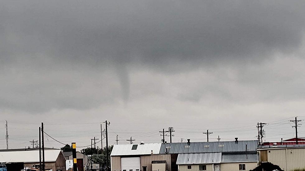
Also, around 11:24 a.m. on Friday K2Radio News received a picture from Wake Up Wyoming host Glenn Woods of what appears to be a Landspout; he said the photo was taken near Mills, East of the airport.

Wyoming-based meteorologist Don Day Jr. told Townsquare Media landspouts are typically weaker than supercell tornadoes:
"A land spout is a weak tornado, poorly formed, they are common in spring especially. They can cause strong wind gusts but they don’t last long on the ground, so for the most part not the concern a well-formed tornado can cause."
Casper Area Sees Flooding Downtown
Gallery Credit: Tom Morton
Crazy Flooding In Bar Nunn Turns Cars Into Boats
Gallery Credit: Laura Loughran Redmond, Heart of Wyoming Photography
More From K2 Radio