NWS Cheyenne: ‘Sudden Drops in Visibility’ on I-80 This Afternoon
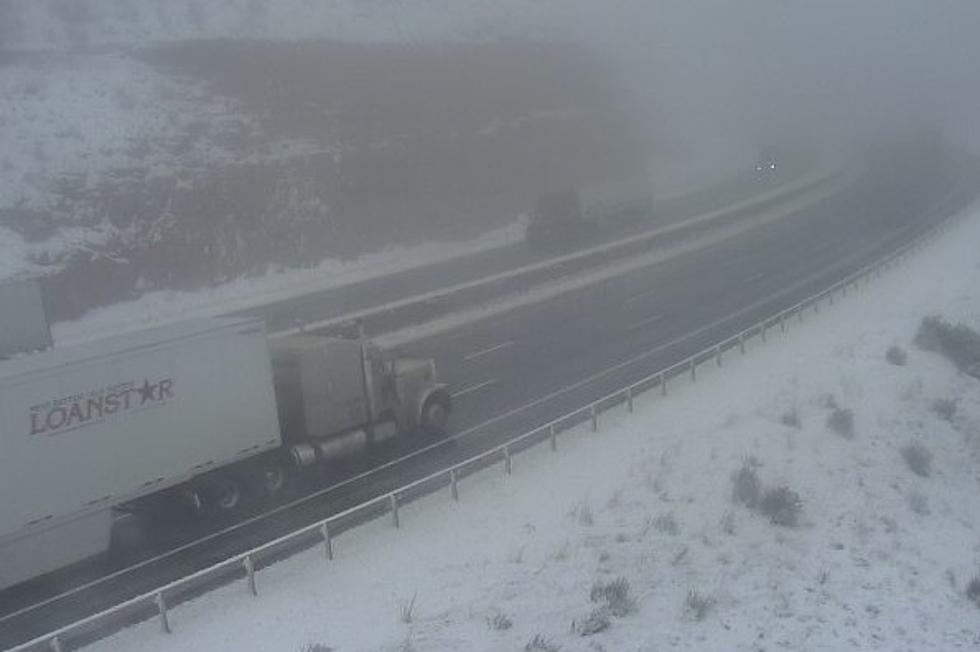
Those traveling on Interstate 80 west of Cheyenne this afternoon will want to be prepared for "sudden drops in visibility," according to the National Weather Service in Cheyenne.
The agency issued the following statement late Monday morning:
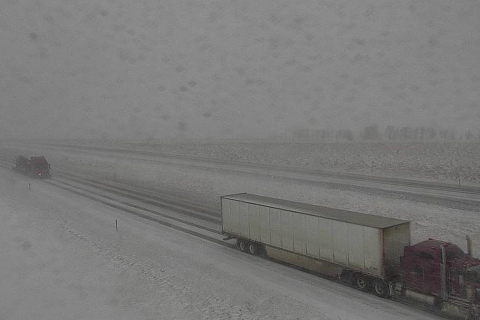
10/1140AM: Greetings! For those traveling on I-80 near/west of Cheyenne, be prepared for moderate to heavy snow this afternoon. The visibility will drop below one quarter of a mile at times. Be aware for sudden drops in visibility this afternoon and allow extra distance between you and the vehicle in front of you.

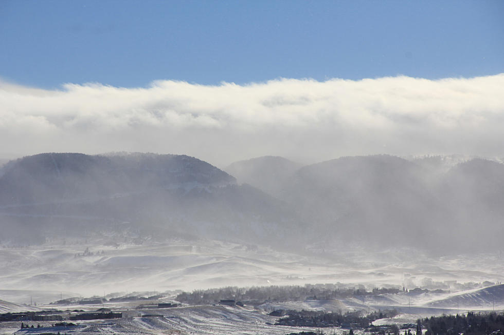
Winter Storm Warnings and Winter Weather Advisories remain in effect until noon Tuesday for much of the area.
URGENT - WINTER WEATHER MESSAGE
National Weather Service Cheyenne WY
144 PM MDT Mon May 10 2021

...MODERATE TO HEAVY SNOW EXPECTED TO IMPACT TRAVEL ACROSS
PORTIONS OF SOUTHEAST WYOMING TODAY THROUGH TUESDAY...

WYZ114-111200-
/O.CON.KCYS.WS.W.0015.000000T0000Z-210511T1800Z/
Snowy Range-
Including the cities of Centennial and Albany
144 PM MDT Mon May 10 2021

...WINTER STORM WARNING REMAINS IN EFFECT UNTIL NOON MDT TUESDAY...

* WHAT...Heavy snow. Additional snow accumulations of up to 7 inches.
  Total snow accumulations of 8 to 14 inches.

* WHERE...Snowy Mountain Range.

* WHEN...Until Noon MDT Tuesday.

* IMPACTS...Mountain travel will be extremely dangerous or
  impossible due to icy, snow packed roads and very low visibility
  in falling snow. Outdoor recreation will be hazardous to those
  caught unprepared for severe winter conditions.

PRECAUTIONARY/PREPAREDNESS ACTIONS...

If you must travel, keep an extra flashlight, food, and water in
your vehicle in case of an emergency.

The latest road conditions for the state you are calling from can
be obtained by calling 5 1 1.
URGENT - WINTER WEATHER MESSAGE
National Weather Service Cheyenne WY
144 PM MDT Mon May 10 2021

...MODERATE TO HEAVY SNOW EXPECTED TO IMPACT TRAVEL ACROSS
PORTIONS OF SOUTHEAST WYOMING TODAY THROUGH TUESDAY...

WYZ116>118-111200-
/O.CON.KCYS.WS.W.0015.000000T0000Z-210511T1800Z/
South Laramie Range-South Laramie Range Foothills-
Central Laramie County-
Including the cities of Buford, Pumpkin Vine, Vedauwoo, Whitaker,
Federal, Horse Creek, and Cheyenne
144 PM MDT Mon May 10 2021

...WINTER STORM WARNING REMAINS IN EFFECT UNTIL NOON MDT TUESDAY...

* WHAT...Snow. Additional snow accumulations of 2 to 4 inches.
  Total snow accumulations of 5 to 10 inches.

* WHERE...South Laramie Range and Foothills. This includes the Interstate
  80 Summit, Buford, Federal, Horse Creek and Vedauwoo.

* WHEN...Until Noon MDT Tuesday.

* IMPACTS...Travel will be hazardous due to icy, snow covered
  roads and low visibility in falling snow.

PRECAUTIONARY/PREPAREDNESS ACTIONS...

If you must travel, keep an extra flashlight, food, and water in
your vehicle in case of an emergency.

The latest road conditions for the state you are calling from can
be obtained by calling 5 1 1.
URGENT - WINTER WEATHER MESSAGE
National Weather Service Cheyenne WY
144 PM MDT Mon May 10 2021

...MODERATE TO HEAVY SNOW EXPECTED TO IMPACT TRAVEL ACROSS
PORTIONS OF SOUTHEAST WYOMING TODAY THROUGH TUESDAY...

WYZ119-111200-
/O.CON.KCYS.WW.Y.0033.000000T0000Z-210511T1800Z/
East Laramie County-
Including the city of Pine Bluffs
144 PM MDT Mon May 10 2021

...WINTER WEATHER ADVISORY REMAINS IN EFFECT UNTIL NOON MDT TUESDAY...

* WHAT...Snow. Additional snow accumulations of up to two inches.
  Total snow accumulations of 3 to 5 inches.

* WHERE...Eastern Laramie County including Pine Bluffs.

* WHEN...Until Noon MDT Tuesday.

* IMPACTS...Travel could be hazardous due to icy, snow covered
  roads and low visibility in falling snow.

PRECAUTIONARY/PREPAREDNESS ACTIONS...

Slow down and use caution while traveling.

The latest road conditions for the state you are calling from can
be obtained by calling 5 1 1.
URGENT - WINTER WEATHER MESSAGE
National Weather Service Cheyenne WY
144 PM MDT Mon May 10 2021

...MODERATE TO HEAVY SNOW EXPECTED TO IMPACT TRAVEL ACROSS
PORTIONS OF SOUTHEAST WYOMING TODAY THROUGH TUESDAY...

WYZ103-106-111200-
/O.CON.KCYS.WW.Y.0033.000000T0000Z-210511T1800Z/
North Laramie Range-
Central Laramie Range and Southwest Platte County-
Including the cities of Garrett, Esterbrook, and Bordeaux
144 PM MDT Mon May 10 2021

...WINTER WEATHER ADVISORY REMAINS IN EFFECT UNTIL NOON MDT TUESDAY...

* WHAT...Snow. Additional snow accumulations of up to 5 inches.
  Total snow accumulations of 6 to 10 inches.

* WHERE...Central and Northern Laramie Range including Bordeaux and
  Esterbrook.

* WHEN...Until Noon MDT Tuesday.

* IMPACTS...Travel could be hazardous due to icy, snow covered
  roads and low visibility in falling snow.

PRECAUTIONARY/PREPAREDNESS ACTIONS...

Slow down and use caution while traveling.

The latest road conditions for the state you are calling from can
be obtained by calling 5 1 1.
URGENT - WINTER WEATHER MESSAGE
National Weather Service Cheyenne WY
144 PM MDT Mon May 10 2021

...MODERATE TO HEAVY SNOW EXPECTED TO IMPACT TRAVEL ACROSS
PORTIONS OF SOUTHEAST WYOMING TODAY THROUGH TUESDAY...

WYZ110-111200-
/O.CON.KCYS.WW.Y.0033.000000T0000Z-210511T1800Z/
North Snowy Range Foothills-
Including the cities of Arlington and Elk Mountain
144 PM MDT Mon May 10 2021

...WINTER WEATHER ADVISORY REMAINS IN EFFECT UNTIL NOON MDT TUESDAY...

* WHAT...Snow. Additional snow accumulations of up to 3 inches.
  Total snow accumulations of 3 to 6 inches.

* WHERE...North Snowy Range Foothills including Arlington and
  Elk Mountain along Interstate 80 between Laramie and Rawlins.

* WHEN...Until Noon MDT Tuesday.

* IMPACTS...Travel could be hazardous due to icy, snow covered
  roads and low visibility in falling snow.

PRECAUTIONARY/PREPAREDNESS ACTIONS...

Slow down and use caution while traveling.

The latest road conditions for the state you are calling from can
be obtained by calling 5 1 1.
URGENT - WINTER WEATHER MESSAGE
National Weather Service Cheyenne WY
144 PM MDT Mon May 10 2021

...MODERATE TO HEAVY SNOW EXPECTED TO IMPACT TRAVEL ACROSS
PORTIONS OF SOUTHEAST WYOMING TODAY THROUGH TUESDAY...

WYZ107-115-111200-
/O.CON.KCYS.WW.Y.0033.000000T0000Z-210511T1800Z/
East Platte County-Laramie Valley-
Including the cities of Wheatland, Guernsey, Laramie, and Bosler
144 PM MDT Mon May 10 2021

...WINTER WEATHER ADVISORY REMAINS IN EFFECT UNTIL NOON MDT TUESDAY...

* WHAT...Snow. Additional snow accumulations of up to two inches.
  Total snow accumulations of 3 to 5 inches.

* WHERE...East Platte County and Laramie Valley. This includes
  Guernsey, Laramie and Wheatland.

* WHEN...Until Noon MDT Tuesday.

* IMPACTS...Travel could be hazardous due to icy, snow covered
  roads and low visibility in falling snow.

PRECAUTIONARY/PREPAREDNESS ACTIONS...

Slow down and use caution while traveling.

The latest road conditions for the state you are calling from can
be obtained by calling 5 1 1.
Drivers are encouraged to call 511 or go to wyoroad.info for the latest road conditions.
Winter Weather Tips From the National Weather Service
More From K2 Radio