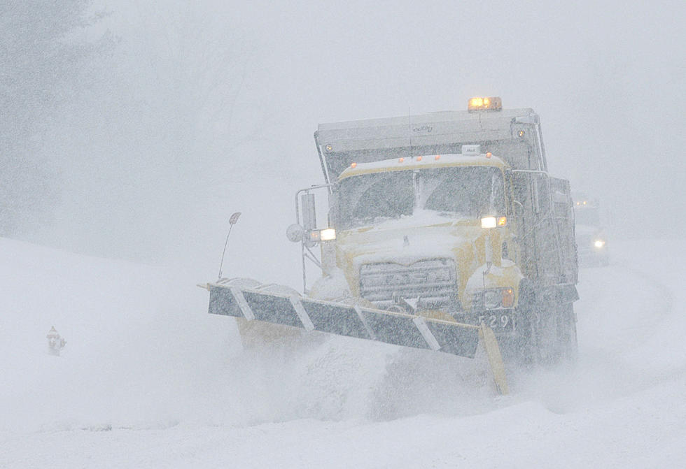
Fall Storm to Impact Wyoming Travel This Weekend [VIDEO]
Fall weather is getting a quick start this year, with a significant storm already impacting travel across Wyoming in the first weekend of the season.
K2 Radio Meteorologist Don Day of DayWeather says mountain and mountain passes will be the most impacted through Monday, though Interstate 80 could see some slick spots between Rawlins and Cheyenne.
Roads are expected to be wet statewide, and hunters will want to keep up with daily forecasts, as getting into some hunting areas may be tricky.
Mountain passes including Togwotee, Teton, South Pass, Powder River Pass, Snowy Range and Battle Mountain will see snow and possible slick conditions this weekend, Day says.
Rain, clouds and wet snow will bring limited visibility across much of Wyoming through Monday, Day says. As far as interstate travel goes, I-80 presents the greatest concern, though travel impact for I-80 is only forecast to be moderate.
The stretches of I-80 between Rawlins and Laramie, as well as Laramie and Cheyenne, could see a bit of snow Saturday night and Sunday morning. Sunday night, Day says, will see the lowest snow levels of this storm system.
Those low snow levels will extend along a larger stretch of I-80 between Rawlins and Laramie, as well as the segment between Laramie and Cheyenne.
The National Weather Service in Riverton says precipitation will continue to slide east through Friday evening. Snow levels varied from 6,500 to 7,500 feet Friday morning, and should fall slightly to between 6,000 and 7,000 feet through early Saturday.
A number of winter weather advisories remain in effect into Friday evening.
Northwestern Wyoming has already seen between half an inch and an inch of widespread precipitation, and similar amounts are expected across that area through 6 p.m. into Friday evening.
Rain, expected to move east of the Continental Divide Friday morning, will continue across the area Friday night, though it will be too warm for any of that precipitation to fall as snow in basins and valleys east of the Divide.
Temperatures will turn even cooler over the weekend, the National Weather Service says, with highs only in the 40s on Saturday and Sunday.
Teton Pass will likely make for a slower trip Friday evening, as the road may be snow-covered or slick at times, according to the NWS. Snow-covered roads are also anticipated at times over Togwotee Pass by Friday evening.
Northwest Wyoming will see the heaviest snow accumulations of eight to 14 inches above 9,000 feet. Most other mountain areas within the NWS winter weather advisory can expect five to 10 inches by Friday evening.
The NWS does not expect snow to hamper travel in the valleys of western Wyoming, but the widespread precipitation may produce falling rock in the canyons -- primarily the Snake and Hoback canyons.
Hunters and anyone else with outdoor plans should prepare for unseasonably cool, wet weather through Sunday, the NWS says.
More From K2 Radio