79 MPH Wind Gust Recorded in Cheyenne; More Wind on Tap
A 79 mph wind gust was recorded at the Cheyenne Airport during the overnight hours, according to the National Weather Service in Cheyenne.
Gusts of 75 mph and 73 mph were also recorded near Bordeaux and Whitaker.

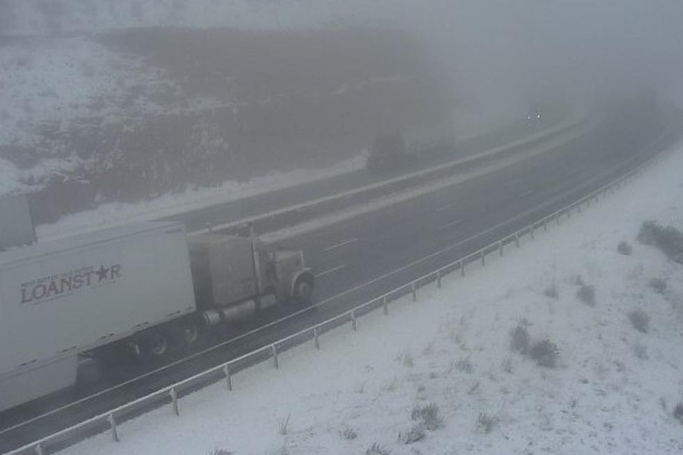
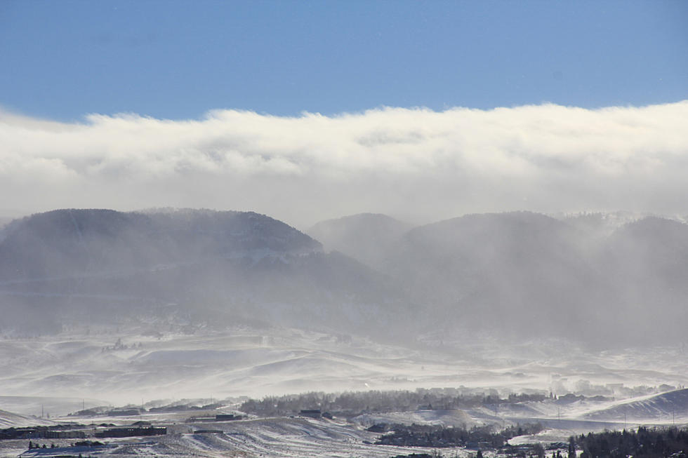
Here are some of the observed peak wind gusts late last night and early this morning. A strong mountain wave near the Laramie Range helped produce wind gusts over 75 MPH near the Interstate 25 corridor. High Wind Warnings continue through the day today for portions of southeast Wyoming.

Unfortunately, the strong winds remain in the forecast through Wednesday, with gusts up to 65 mph expected in central Laramie County until 5 p.m. today and gusts up to 75 mph expected in the south Laramie Range and adjacent foothills until 5 p.m. Wednesday.
URGENT - WEATHER MESSAGE
National Weather Service Cheyenne WY
1042 AM MST Tue Dec 21 2021

WYZ116-117-220000-
/O.CON.KCYS.HW.W.0061.000000T0000Z-211223T0000Z/
South Laramie Range-South Laramie Range Foothills-
Including the cities of Buford, Pumpkin Vine, Vedauwoo, Whitaker,
Federal, and Horse Creek
1042 AM MST Tue Dec 21 2021

...HIGH WIND WARNING REMAINS IN EFFECT UNTIL 5 PM MST WEDNESDAY...

* WHAT...West winds 35 to 50 MPH with gusts up to 75 MPH
  expected.

* WHERE...South Laramie Range and adjacent foothills including
  Interstate 80 between Laramie and Cheyenne.

* WHEN...Until 5 PM MST Wednesday.

* IMPACTS...Mainly to transportation. Strong cross winds will be
  hazardous to light weight and high profile vehicles, including
  campers and tractor trailers. There will be a high risk for
  vehicle blow overs, particularly along north to south oriented
  roadways.

PRECAUTIONARY/PREPAREDNESS ACTIONS...

People should avoid being outside in forested areas and around
trees and branches. If possible, remain in the lower levels of
your home during the windstorm, and avoid windows. Use caution if
you must drive.
URGENT - WEATHER MESSAGE
National Weather Service Cheyenne WY
1042 AM MST Tue Dec 21 2021

WYZ118-220000-
/O.CON.KCYS.HW.W.0061.000000T0000Z-211222T0000Z/
Central Laramie County-
Including the city of Cheyenne
1042 AM MST Tue Dec 21 2021

...HIGH WIND WARNING REMAINS IN EFFECT UNTIL 5 PM MST THIS
AFTERNOON...

* WHAT...West winds 35 to 45 mph with gusts up to 65 mph
  expected.

* WHERE...Central Laramie County including the city of Cheyenne.

* WHEN...Until 5 PM today. Winds could remain elevated tonight
  through Wednesday.

* IMPACTS...Mainly to transportation. Strong cross winds will be
  hazardous to light weight and high profile vehicles, including
  campers and tractor trailers.

PRECAUTIONARY/PREPAREDNESS ACTIONS...

People should avoid being outside in forested areas and around
trees and branches. If possible, remain in the lower levels of
your home during the windstorm, and avoid windows. Use caution if
you must drive.
URGENT - WEATHER MESSAGE
National Weather Service Cheyenne WY
1042 AM MST Tue Dec 21 2021

WYZ110-220000-
/O.CON.KCYS.HW.W.0061.000000T0000Z-211222T1800Z/
North Snowy Range Foothills-
Including the cities of Arlington and Elk Mountain
1042 AM MST Tue Dec 21 2021

...HIGH WIND WARNING REMAINS IN EFFECT UNTIL 11 AM MST
WEDNESDAY...

* WHAT...West to southwest winds 35 to 45 MPH with gusts up to
  65 MPH expected.

* WHERE...North Snowy Range Foothills including Arlington and
  Elk Mountain along Interstate 80 between Laramie and Rawlins.

* WHEN...Until 11 AM MST Wednesday.

* IMPACTS...Mainly to transportation. Strong cross winds will be
  hazardous to light weight and high profile vehicles, including
  campers and tractor trailers.

PRECAUTIONARY/PREPAREDNESS ACTIONS...

People should avoid being outside in forested areas and around
trees and branches. If possible, remain in the lower levels of
your home during the windstorm, and avoid windows. Use caution if
you must drive.
READ MORE:
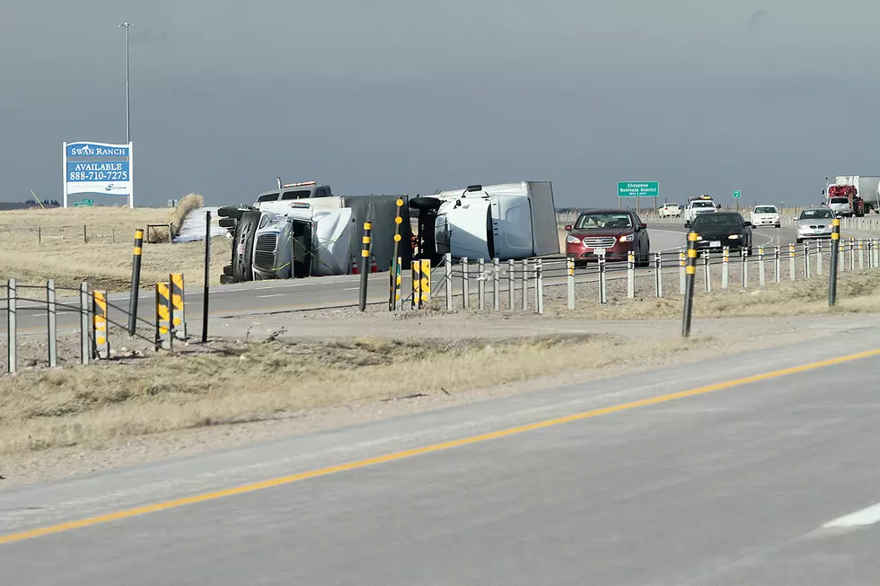
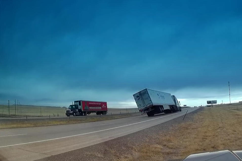
- WATCH: Brutal Wind Topples Semi on I-25 South of Cheyenne
- NWS Cheyenne: It Hasn't Been This Windy in 15 Years
TIPS: Here's how you can prepare for power outages
KEEP READING: Get answers to 51 of the most frequently asked weather questions...
More From K2 Radio