

Explore Wyoming’s Wild Spaces Like Never Before With This Tool
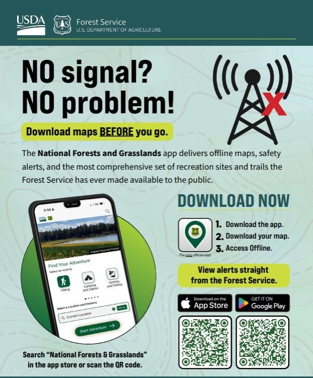
Your adventures in Wyoming's National Forests and Grasslands just got easier for this summer. The USDA has launched a new app chock-full of maps, trails, safety alerts, and other critical information you'll need when you're in an area without service.
This app is a great addition to your collection of adventure apps. First, and foremost, because phone coverage isn't guaranteed everywhere you go in Wyoming, knowing that you can download and still have access to maps of the area you're in, and even share your location in the event you are lost and need help.

I downloaded the app and, within two minutes, had the plans, directions, and available options for an adventure that I didn't know I needed. If you're someone who doesn't have extra time to plan adventures and love the spur-of-the-moment trips, you'll dig it.
I also enjoy the feature that helps you find an adventure near you. All you'll need to do is find the trail, campsite, orv trail, horse riding trail, picnic area, educational area, scenic drives, rock climbing areas, or other areas that interest you, choose it on the app, and boom, you're off on an adventure, no matter where you are in Wyoming.
Forest Service Chief Tom Schultz says:
Due to the sheer size and remote nature of our 165,000 miles of trails and more than 30,000 recreation sites, we know that mobile service can be limited once you reach your destination. We encourage everyone to download the National Forests and Grasslands app – your own pocket-sized Forest Service guide – to check trail conditions, download offline maps, and view safety alerts before your trip.
The National Forests and Grasslands app is available for download on the Apple Store for iOS and Google Play for Android.
Explore Wyoming's Medicine Bow National Forest
Wyoming's Beauty Runs Deep In Shoshone National Forest
More From K2 Radio

