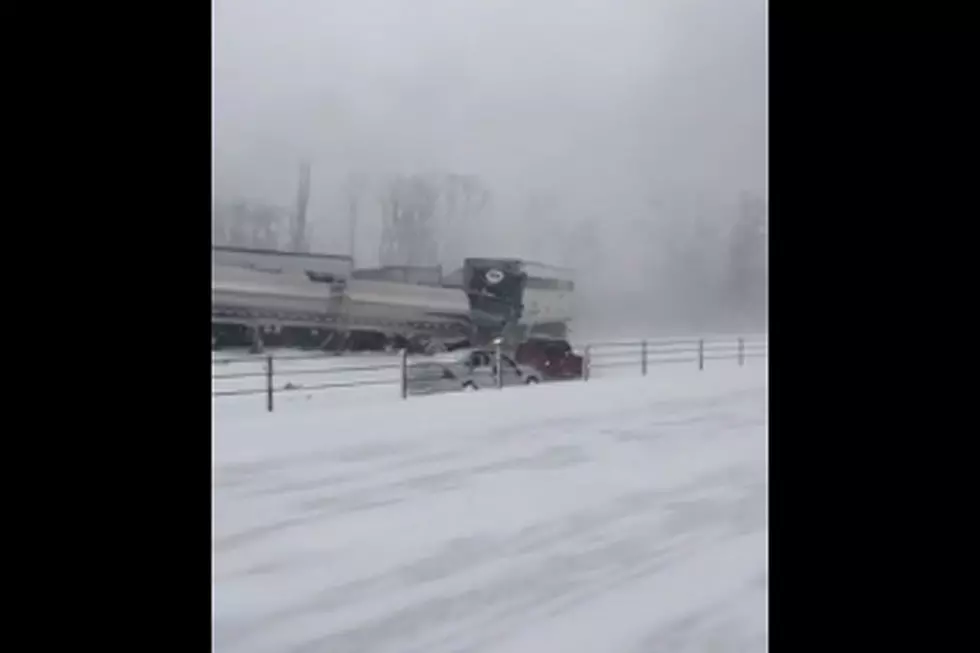
Colder Today With Scattered Snow & Fog In Southern WY
Light snow will gradually taper off across northern and central portions of the state this morning, but a chance for snow will continue throughout the day in southern Wyoming due to a low pressure system settled to our south. There will be an increasing chance for snow in far southwestern Wyoming, especially near Evanston to Rock Springs, during the afternoon hours as this weather system approaches the area. This will then spread east along I-80 this evening into Tuesday morning with some new snow accumulations possible. Reduced visibility is expected for the rest of today into Tuesday morning along I-25 (Colorado state line to Wheatland), US-85 (Colorado state line to Torrington) and all of I-80 due to light to scattered snow shower activity and areas of patchy freezing fog. Slick, icy and some snowy roads will also be possible in these areas. Expect improving visibility and travel conditions for northern and central Wyoming by this afternoon and evening. Temperatures will also be noticeably colder statewide today with daytime highs staying in the 20's and 30's. Light snow will continue throughout southern Wyoming into the late morning/early afternoon hours on Tuesday. Areas of freezing fog will also be possible in the morning. Travel concerns will continue along I-80 and southern parts of I-25 and US-85 into Tuesday afternoon. Otherwise, expect partly to mostly cloudy skies and colder than normal temperatures.
More From K2 Radio